

|
|
|
#61
 02-13-2018, 11:55 AM
|
||||
|
||||
|
Quote:
__________________
http://less-than-epic.blogspot.com/ 
|
|
#62
02-13-2018, 12:23 PM
|
|||
|
|||
|
@cgolvin Strave is great too.
I’m staying in Venice Beach and have a meeting at 10:30 in Palos Verdes. I haven’t scheduled anything for Friday afternoon so should have from 12:30 on for a ride. Debating whether to: a) take bike in the car and do a ride from PV. I would then have to drive back up to Venice after the ride, which would I guess be at rush hour and bad traffic? But I get maximum daylight. B) drive back North after the meeting to Malibu or thereabouts and ride there all Friday afternoon. A bit later a start, but I wouldn’t have much of a drive after the ride. I’ll be on a borrowed road bike with 28s. (Unless I succeed in buying a bike I just found on CL)
|
|
#63
02-13-2018, 12:48 PM
|
||||
|
||||
|
Quote:
Personally it's an easy choice -- (B) since the Santa Monica mountains offer a greater diversity of options. I'm sure folks from the South Bay know some additional add-ons but if I were to start from PV at 12:30 I'd be done well before sunset even throwing in a couple of spurs. But starting north of Santa Monica you've just got loads of choices. I have a route that traverses 5 different ways up to Saddle Peak, like 12K of climbing all within a constrained area. Or, if you're keen to ride on PCH, plenty of long steady climbs. Traffic on a Friday afternoon is bad, no way around it. The good news is that from PV to Venice there's a long section of bike path and if you're returning on PCH the traffic is heavier northbound.
|
|
#65
02-13-2018, 01:13 PM
|
||||
|
||||
|
PV routes
OK, here you go. These all start from the bridge in Marina Del Rey that crosses Ballona Creek.
Short route (aka "the doughnut hole"): https://www.strava.com/routes/11956834 Medium route: https://www.strava.com/routes/11956899 Max climbing route: https://www.strava.com/routes/7193277 Easy adaptation of the last route: excise the detour through the shopping center and first climb coming out of PV and simply continue on Palos Verdes Drive West, you will then cross Hawthorne Blvd. (approx mile 20.6) and continue on the route. I made the first two by altering the last one just now and it's possible that Strava did something weird with the waypoints, so don't let your GPS veto your brain. Let me know if any questions. Happy to provide additional routes through the Santa Monicas too.
|
|
#66
02-13-2018, 01:27 PM
|
||||
|
||||
|
thanks cg, much appreciated.
__________________
http://less-than-epic.blogspot.com/
|
|
#67
02-18-2018, 10:24 PM
|
|||
|
|||
|
took one of the posted routes here and did this Friday.
https://ridewithgps.com/trips/20816564 but i would recommend this slightly modified version https://ridewithgps.com/routes/26877978 Borrowed this spicy meatball which took me up Latigo Canyon. Of course work took longer than expected on Friday so then I didn't end up getting started on the ride until like 4 pm. But I wasn't gonna let it stop me and it was pretty great. I was racing against the sun and lost. I was totally unprepared for this ride as I had banked on way more free time but then work got in the way. Didn't have any water or any snacks and there was nowhere to stop after PCH. I was pretty dumb. I did think to pack a headlight, thanks god, but turned it on and battery indicator was red. Oops. Saved the juice for the descent and finished up the climbing in the dark. Then the route I mapped surprise-turned me onto some trails, which was ok, but then the trails disappeared or at least I couldn't find them in the dark with my headlight, so had to re-route on the fly. But still a blast. Can't wait to go back, which I think wont be too long. 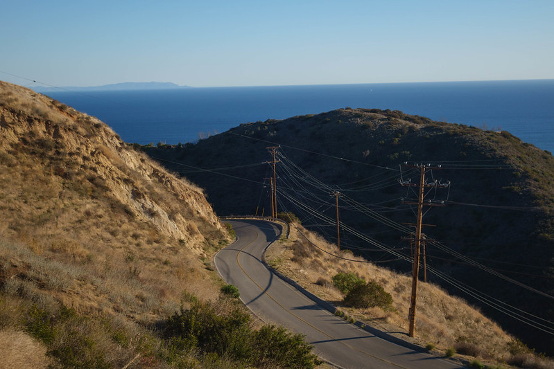 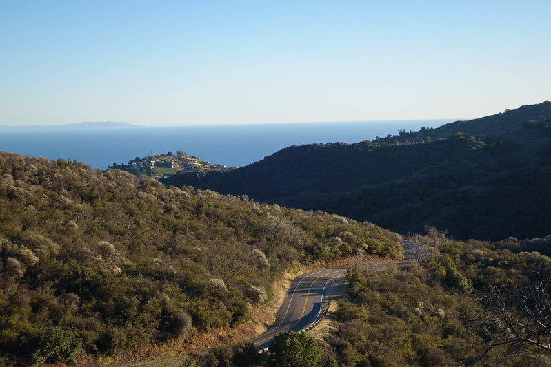 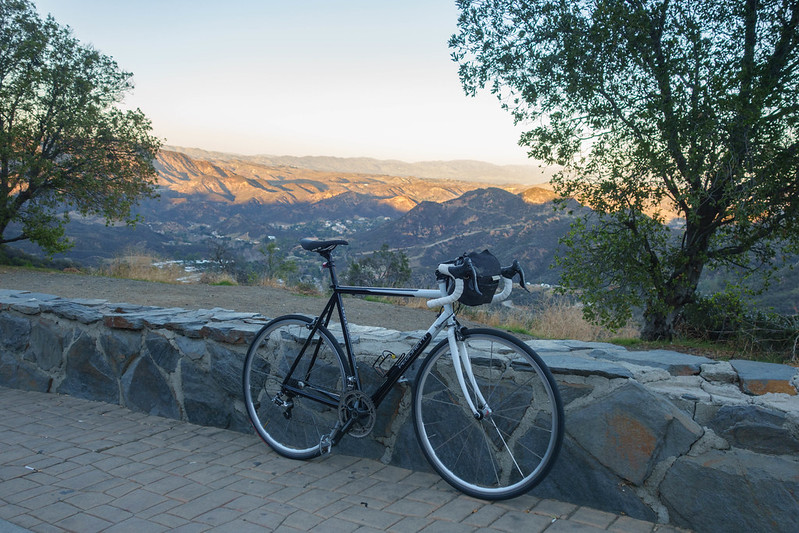 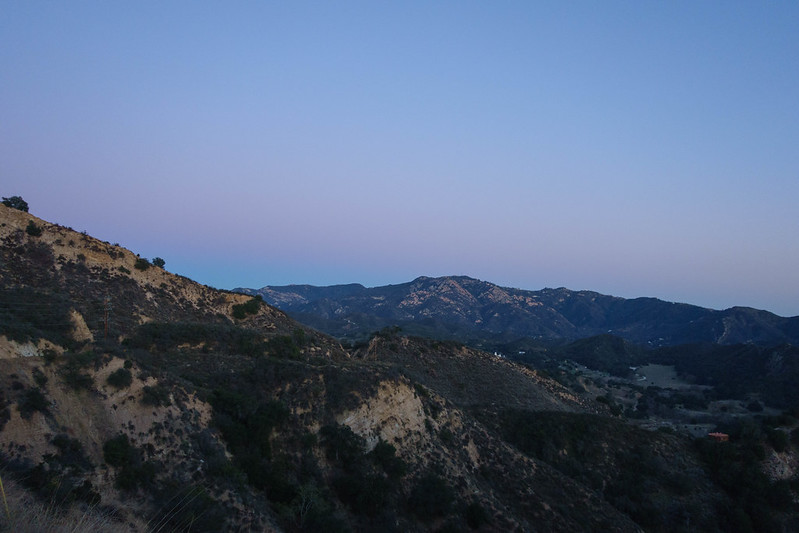 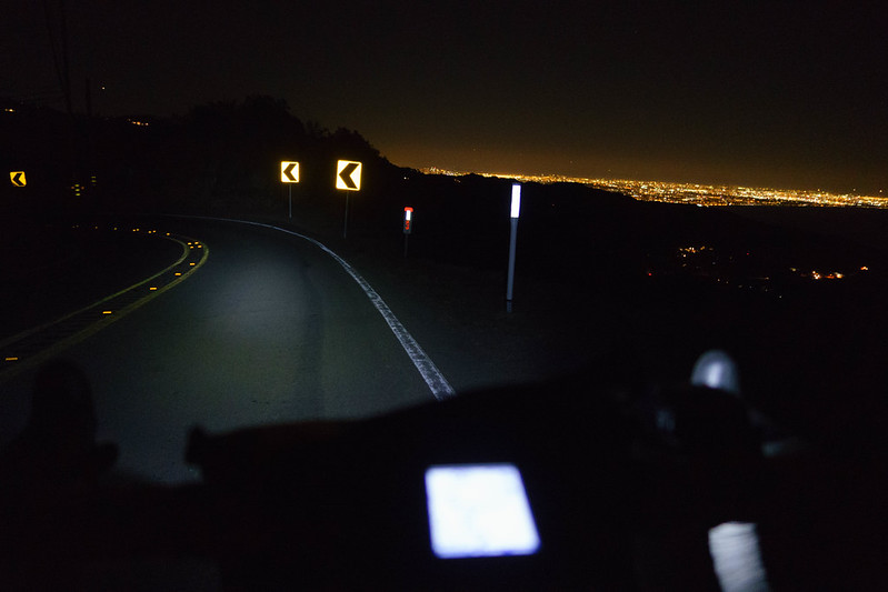 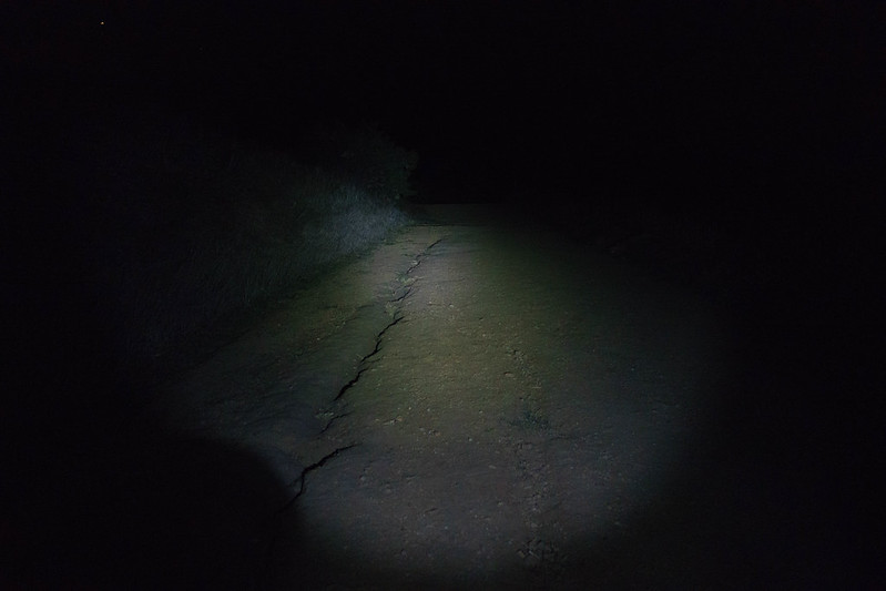
|
|
#69
02-19-2018, 12:52 PM
|
||||
|
||||
|
Quote:
Next time, if it's daylight, stick with the original route — the Tuna descent is worth it. (It's a great climb, too, if you don't mind flouting the law, just stay alert to descending traffic.) Oh, and for others who might want to use the route, there are water stops which I'm happy to document, just ask. Last edited by cgolvin; 02-19-2018 at 12:54 PM. Reason: added water stop info
|
|
#70
02-19-2018, 01:05 PM
|
||||
|
||||
|
looks good! i may do just this next week.
__________________
http://less-than-epic.blogspot.com/
|
|
#71
02-19-2018, 01:31 PM
|
||||
|
||||
|
Quote:
|
|
#72
03-02-2018, 07:45 AM
|
||||
|
||||
|
thanks to adam for the route i sniped and did a couple days ago.
weather was cooperative, maybe a bit windy and not as warm as i had hoped, but overall, good weather for a february ride i did in bibshorts and a short sleeve jersey. left my windbreaker at the hotel accidentally and should have brought it, it would have made the descents a bit more pleasant, but no big deal. the descent off tuna canyon road is pretty good! rented one of the nicer bikes i've been able to use travelling. carbon tarmac with dura ace. not bad!  didnt bring the gps or any computer, so old school cue sheet was the ticket.    
__________________
http://less-than-epic.blogspot.com/
|
|
#73
03-02-2018, 07:57 AM
|
|||
|
|||
|
Any recommendations for more inland rides?
I'm staying in Glendale soon so most of the coastal rides posted in this thread might be a little out of reach for me. Does anyone have any routes around Griffith Park or anything north? It looks like Verdugo Mountains, Wildwood Canyon, and La Tuna Canyon are all within a reasonable distance. I'm also probably going to find a cyclocross bike to rent so off-road suggestions would be great, too.
|
|
#74
03-02-2018, 10:39 AM
|
||||
|
||||
|
Quote:
I don't know the connections from around Glendale like LaTuna, but would recommend that you head up into the San Gabriel mountains if possible. For example, here is a 35 mile 4K loop starting on Foothill Blvd, which you could bridge to from Glendale. If you want to add to it, turn left instead of right on Angeles Forest Highway, then right on Upper Big Tujunga, then right on Angeles Crest Highway, which will loop you back to the junction of AFH & ACH on the route. For additional elevation, there's the spur at Red Box up to Mt. Wilson. If this sounds interesting I can also provide guidance on water stops; also beeatnik and others who know the east side better than I can, I'm sure, suggest some offroad pieces.
|
|
#75
03-02-2018, 10:43 AM
|
||||
|
||||
|
Quote:
Tuna is indeed a fabulous descent, though a couple of friends have melted their carbon wheels on it. Glad you enjoyed your visit, hope I can join next time.
|
 |
|
|


 Linear Mode

